

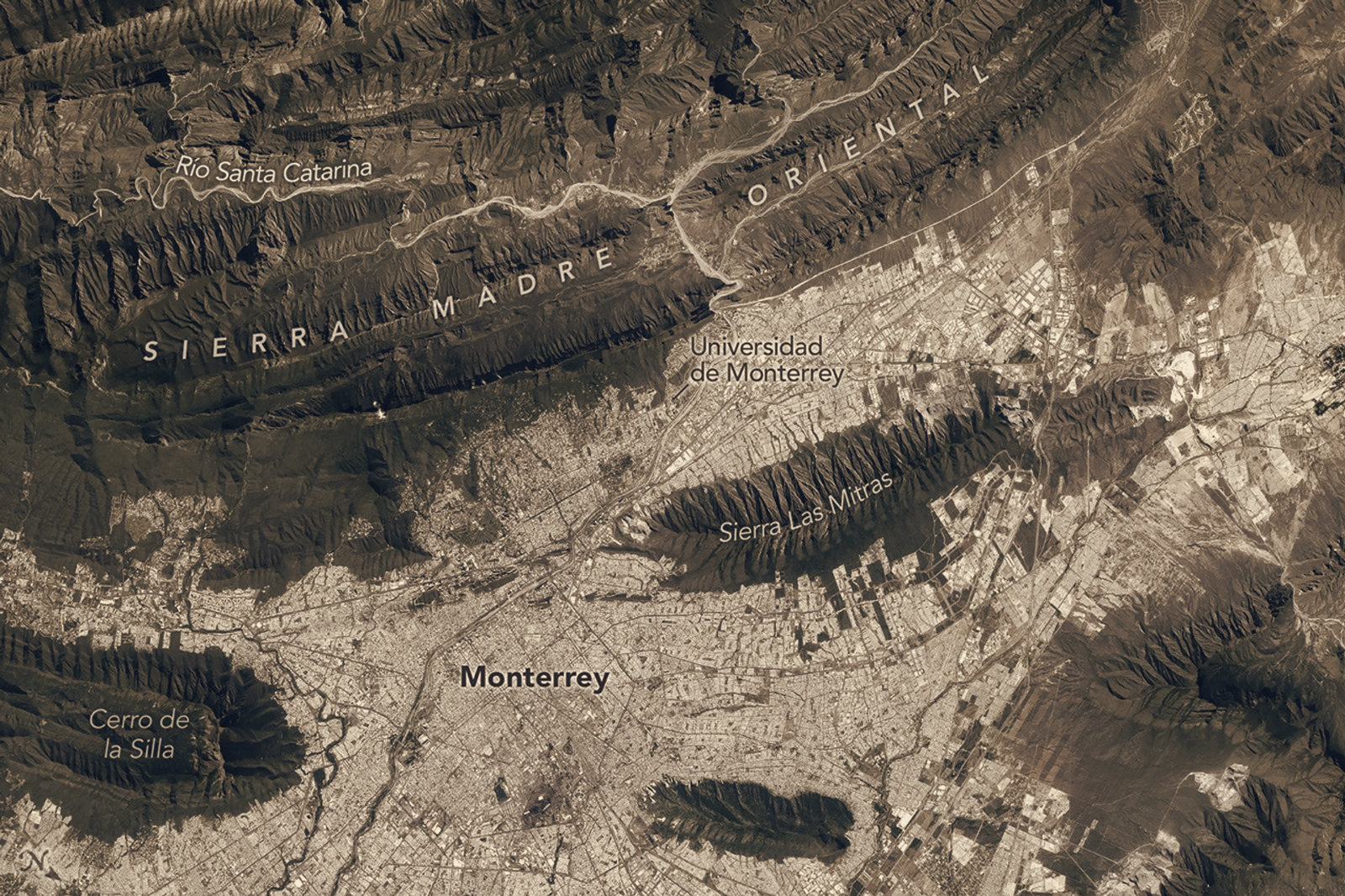
Monterrey now appears in NASA imagery as a city pressed up against the folded rock ridgelines of the Sierra Madre Oriental, a relationship made clear in an Earth Observatory photograph published 2026-09-11T04:01:00.000Z. The picture emphasises how a major metropolitan area sits at the edge of steep, sinuous terrain, where repeating ridge crests form a striking backdrop to urban blocks.
The image identifies Mexico’s second-largest metropolitan area immediately adjacent to the mountain belt, and highlights the curving, parallel ridges that characterise this segment of the Sierra Madre Oriental. Captured as part of NASA’s astronaut photography and Earth Observatory collections, the photograph is categorised under topography and urban development, signalling the agency’s interest in documenting landscapes where built and natural environments meet.
Viewed from orbit, the ridgelines read like folded layers of rock running roughly parallel to one another, a structural pattern that shapes local drainage, slope and the visible margin between city and mountain. The shot provides a clear visual record of the boundary between Monterrey’s urban fabric and the high-relief geology rising to the east and northeast of the metropolitan area.
NASA’s Earth Observatory has made this and similar images available to the public as part of its photograph collections, where they serve as immediate visual references for topography and urban development. The image does not include analytical claims about causes or impacts, but it documents the spatial layout that planners, researchers and residents can examine when considering how the city and the surrounding terrain interact.
Readers can find the photograph within NASA’s public image collections for closer inspection, where instrument and photography metadata accompany the visual to help specialists and interested members of the public explore the terrain and urban pattern depicted.