
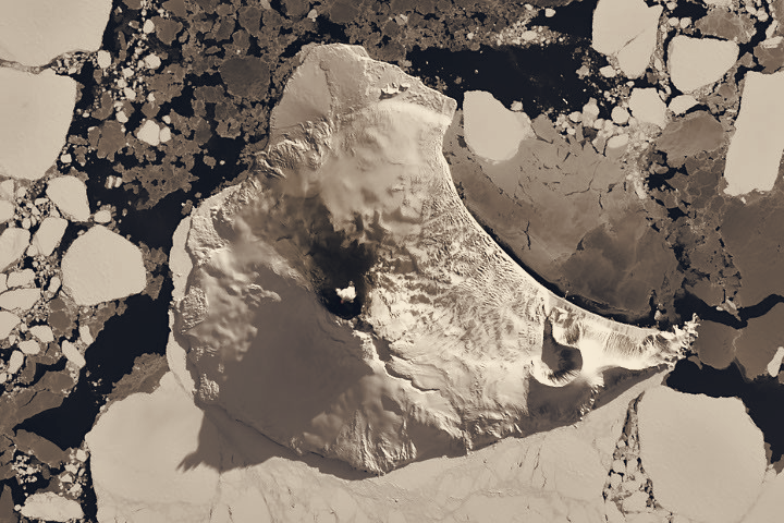

A clear satellite window on August 24, 2026, revealed heat at Mount Michael’s summit crater, reinforcing prior evidence that the remote South Atlantic volcano hosts a persistent lava lake and giving scientists a rare direct view for monitoring. The image, captured by the Operational Land Imager on Landsat 8, combines natural color with an infrared overlay that highlights thermal anomalies in red, showing the summit lake’s signature glow and a small volcanic plume.
Mount Michael sits atop Saunders Island, part of the South Sandwich Islands, a volcanic chain roughly 350 kilometers (220 miles) long formed where the South American plate subducts beneath the South Sandwich plate. The peak rises to an elevation of 843-meter-high (2,766-foot-high) and commonly produces eruptions; its isolation means satellites are the primary way researchers track its activity.
Researchers previously reached their conclusion about a persistent lava lake after analyzing 30 years of thermal data from Landsat, Sentinel, and ASTER. The August 24 image adds to that record by showing active heat at the crater and areas of darkened snow on the volcano’s northern slopes. Long-term thermal monitoring has also used MODIS and VIIRS instruments, while MIROVA, a near-real-time hot spot detection system, has logged low-intensity activity at Mount Michael for several years.
Other satellite observations indicate ongoing degassing. NASA’s Aura satellite has detected emissions of sulfur dioxide and other gases from the volcano, and false-color data from the Aqua satellite suggested a volcanic track of sulfur dioxide downwind of the island. One week after the Landsat 8 pass, Landsat 9 returned to find the atmosphere more active, with passing winds and the island’s topography producing a series of wave clouds resembling a ship’s wake.
The clear imagery was temporary; cloud cover soon returned over the region. Nevertheless, the August 24 observations underline the value of multi-sensor satellite archives for studying remote volcanoes. The combined use of thermal bands, moderate-resolution imagers, and near-real-time detection systems continues to provide the only consistent means to observe Mount Michael’s persistent activity and its atmospheric effects.